

The project involves the development of an interactive mapping application aimed at improving visitor experiences and navigation at the zoo. Through the use of GIS technologies, the application enables efficient routing, search functionality, and highlights key attractions. The app is designed for multi-device accessibility, making it easily accessible to a wide range of users. Overall, the project aims to enhance visitor satisfaction and provide a user-friendly platform for navigating the zoo's premises.

-
INITIATION & DATA PREPARATION
-
NETWORK ANALYSIS & TOPOLOGY
-
WEB MAP & INITIAL APP DEVELOPMENT
-
VALIDATION
-
TRANSITION TO OTHER PLATFORMS
-
DATA OUTPUT
PROJECT DEVELOPMENT STAGES
Data Analysis

-
Routing network layer created from roads within the zoo
-
Configured attributes for travel time, distance, and optimized routes
-
Enhances visitor navigation and reduces congestion
Network Analysis in ArcGIS Pro

-
Routing network layer created from roads within the zoo
-
Configured attributes for travel time, distance, and optimized routes
-
Enhances visitor navigation and reduces congestion
Web Map Creation
in ArcGIS Online

Web Mapping Application Development - Web AppBuilder
-
Developed using ArcGIS Online's Web AppBuilder
-
Customizable interface for user-friendliness
-
Includes interactive maps, search, routing, and location-based services

DATA VALIDATION

-
Verified data accuracy using high-resolution satellite imagery
-
Identified inconsistencies between digitized data and satellite imagery
-
Improved data quality by aligning it with reliable satellite imagery
Satellite Imagery
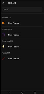
Field Mapping/Survey 123
Verified data accuracy using high-resolution satellite imagery
Identified inconsistencies between digitized data and satellite imagery
Improved data quality by aligning it with reliable satellite imagery


3D Modelling using Polycam and ArcGIS Urban


By strategically merging Models created through PolyCAM and ArcGIS Urban, I have been able to create captivating and immersive experiences for users. One of my standout achievements involves integrating the power of Polycam's 3D scanning capabilities with ArcGIS Urban's robust urban planning and mapping features, culminating in a dynamic fusion that takes 3D navigation to new heights. This fusion, carefully orchestrated and curated, was then masterfully woven into a Web scene, amplifying its impact and accessibility.
The result is a stunning, interactive digital environment that offers an enhanced experience, providing users with a visually engaging and informative journey through urban landscapes. This integration not only exemplifies my technical proficiency but also underscores my commitment to pushing the boundaries of what is possible in the realm of 3D navigation and urban planning, ultimately delivering superior solutions for enhanced user experiences.

Final Product:
Calgary Zoo Navigation Web App

The central hub of the web map app, featuring seamless integration of both 2D and 3D navigation options, offering users a versatile exploration experience.

A dedicated section allowing users to immerse themselves in a three-dimensional exploration of the environment, offering a unique perspective and deeper insights.

An invaluable component that encourages user feedback and suggestions, fostering continuous improvement and refinement of the web map app for an enhanced user experience.
The central hub of the web map app, featuring seamless integration of both 2D and 3D navigation options, offering users a versatile exploration experience.